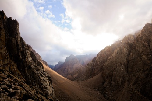
Once upon a time, there was a land without a name. Vast spaces devoid of people, stepplike plains, glaciers, fjords, deserts, lakes, impenetrable forests, canyons, mountains.
Nomads called Tehuelces travelled these boundless spaces from east to west, following their hunting habits.
Magellanes was the first European to encounter them in 1520 and he was so astonished by their average height of 1m80 that he gave them the name “Patagons”, after the giant in the novel “Primaleón” that appeared in 1512 in Salamanca, Spain. (The European average at that time was 1m50).
In the centuries that followed, the Mapuches, another indigenous tribe with its origins in today Chile, slowly displaced the Tehuelces due to their superiority in war techniques and the use of the horse brought by the Europeans. For the central government in Buenos Aires the Mapuches though signified an important resistance against the advance of the Hispanics in the 17th and 18th century. Nevertheless this resistance was broken with the “Campaña del Desierto” in 1879, a war against the indigenous population with the aim of colonialising Patagonia, resulting in a genocide of 20’000 people.
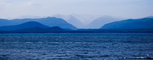
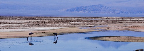
The deserted lake side seen from Bariloche
During all times, Patagonia attracted the people. First Englishmen appeared in their conquest of the seas during the 16th century, then European scientists thirsty for new discoveries in the 18th and early 19th century, then missionaries that brought the cross and finally exiled people who did not have any other place to go. After the “Campaña del Desierto” in the 19th, the land was distributed to soldiers and landlords from Chile, Yugoslawia, Wales, Poland, Scotland, Denmark, England and Holland. The few indigenous people that survived the war were enslaved.
About twenty years ago a new race of conquerors appeared in Patagonia, the millionaires.
With their fortune, they could acquire large parts of land in very little time: Patagonia has become a topic at the table of the rich.
But before anybody is able to buy land, someone needs to sell it. The local government played an important role in selling Patagonia to foreign investors. They kept silence when indigenous communities claimed land they had been cultivating for years and in other cases they gave crucial information to the potential buyer (for example about the original owners of the ground) as if they were an real estate agency. It is not a surprise that many officials really opened their own real estate agency after leaving the public sector. Between 1996 and 1998 a particular government official authorized the sale of 8 mio hectares near the boarder region, which corresponds roughly to twice the surface of Switzerland! (Selling real estate in a area within 50km from the boarder has to be authorised by the state.) Even nowadays a clear policy on the subject of selling homeland is missing and many people fear for the sovereignty, the environment, the rights of indigenous populations and simply for their future; but Buenos Aires is a long way from Patagonia and although that part of the country is important economically (gas ressources, wool and meat production, mining, tourism) the number of voters is bigger in a single suburb of Buenos Aires than in the whole Patagonia with a population of 2 millions people.
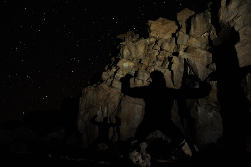
Magic shadows on magic mushrooms
The four biggest foreign landowners in Patagonia own a terrain big as half of Switzerland. On a larger scale, 10% of the surface of Argentina (270’000km2) is owned by strangers (2006).
The Benetton family, known for its textile industry, possesses more than 1 million hectares and it is the biggest landowner in Argentina beside the state. It is one of the major producers of wool and pork meat in Argentina, but also it is involved in forest managment and less publicly advertised because of the environmental issues, in mining. The family members consider their land as an investment which has to give a return. In 2002 a scandal with a dislodged Mapuche family biased the sales and the image of Benetton. By offering 2500 hectares to the indigenous community, the conflict could be mitigated (the land was restitued only in 2007), however tensions continue up to the present day.
Douglas Tompkins, who travelled Patagonia in young ages and even opened a route on the Fitz Roy, made his fortune as founder of The North Face and Esprit brands. He is the biggest private owner of natural resources in Chile and received the nickname of “Lord of the Water”, since his lands are situated on top of an incalculable amount of ground water. It is said that Patagonia shelters one of the main reserve of fresh water in the world. In the south of Argentina and Chile he owns more than 900’000 hectares, principally with the aim of nature preservation, in the sense of “Deep ecology“, a movement which propagates the return to the nature, much in contrast with the idea of some Chileans to populate the land to the very last bit. His territory cuts Chile in two parts which created considerable controversy.
Rather than investing in a private jet, he buys more land in order to protect it. Much of his land has now the status of natural park and in Argentina his land donation to the state is among the biggest in the Argentinean history.
Ted Turner, media mogul and founder of CNN bought more than 40’000 hectares pushed by his passion for trout fishing. He is also among the biggest owners of private land in the USA.
Joseph Lewis, 6th richest man in the UK in 1996 due to his activities in restaurant chains, golf courses, textile industry, biotechnology, gas extraction, etc… built his own paradise near El Bolsón: an entire lake of 600 hectares encircled by mountains, hidden in a forest of Alerce trees, many of them older than 4000 years. His property extends over more than 14’000 hectares. He is heavily contested by some inhabitants of the region and loved by others. Nevertheless, he has been polishing his image with gifts to the local community such as hospitals, emergency vehicles, libraries, an aerodrome, scholarships and good salaries so that locals gave him the nickname of “Tío Joe”.
Way Lard, the grandson of the inventor of the chips, owns the chips company Lay and Pepsico Inc. and makes big profits with VIP tourism and vineyards.
The list of foreign landowners is infinite, some are certain (Jacobo Suchard (Nestle), Swarowski family, etc.), some are just rumors (Silvester Stallone).
Finally, Patagonia has always been owned by strangers. And as the former president Menem put it “Lo que sobra en Argentina es tierra” that is “There is land to be wasted”.
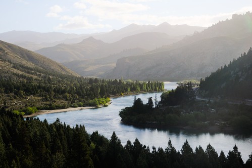
Last sunshine on the Limay river
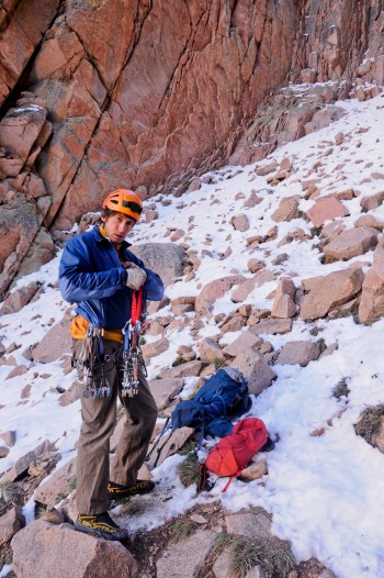
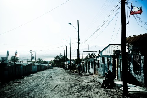
As a matter of fact, we also experienced at first hand what private property in Argentina means. Every now and then throughout our trip we heard about a climbing paradise near San Carlos de Bariloche called “Valle Encantado” (the enchanted valley). Rumors about a river crossing with an inflatable boat, a compulsory permit to enter the private ground and an interdiction to camp made our undertaking as difficult as would be the climbing of the tower of the “Rapunzel” occupied by a short haired princess. We started with what seemed to be the easiest one of the three quests that had been imposed on us: the permit to enter the private property. The magic crystal ball (internet) told us to go to the “Club Andino Bariloche”, the local mountain club, where they gave us only a telephone number which never answered, a dead end. In the different sport shops that we inquired we only obtained a vague description of an office that we could not find. It was as if some dark power would put obstacles in our way, we were getting crazy! Finally a phone call to a contact that we had obtained two weeks earlier in a shop in Salta (!) could solve it. We finally found the ominous office, but it was already closed that evening.
The next day we were supposed to leave, having solved none of our quests but we still had a distant hope of reaching our paradise. We were already sitting in the bus station waiting to be driven to our plan B climbing spot Villa Llanquin when the miracle happened: out of boredom we started to ask in the tourist office whether they had heard of Valle Encantado, only the be provided with the crucial information of what phone number to call for the permit, how to cross the river and where to find a place to spend the night. We had found the fairy godmother! After some phone calls everything was arranged. After all we decided to spend a day in Villa Llanquin, waiting for Adrien who we had met in Arenales to join us and then headed together to Valle Encantado. Adrien in the meantime was able to obtain the permit to enter the private ground.
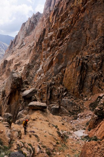
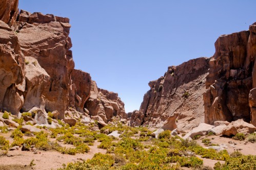
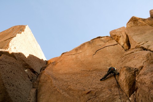
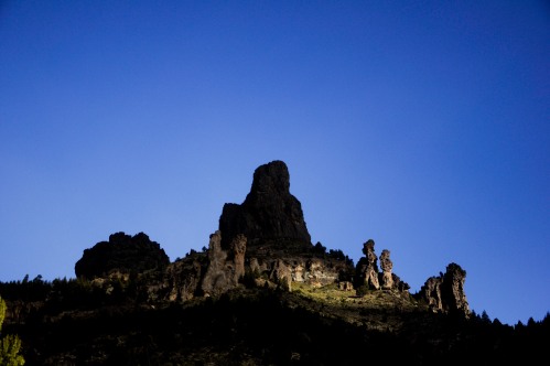
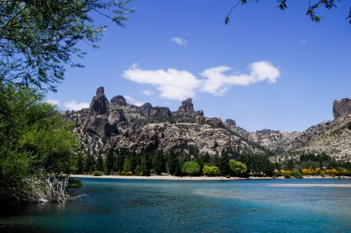
On the next day, we took the bus to km 1201 on the “Ruta 40” and were dropped along the river opposite to some vacation cabins for rent and above all opposite to the incredible natural rock sculptures of Valle Encantado.
We cried and whistled trying to find out the magical saying that would awake the ferryman and finally we were successful. Luis, the guardian of this little paradise made us cross the turquoise river to the “estancia” consisting of some central buildings such as a winter garden, some verandas with big fireplaces, a house for the “asado”, a chapel, a kitchen and the more remotely located wooden holiday cabins. We chose one of the cabins and headed directly to the property next to the one we were, where the actual climbing areas are located.
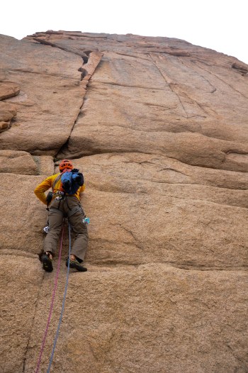
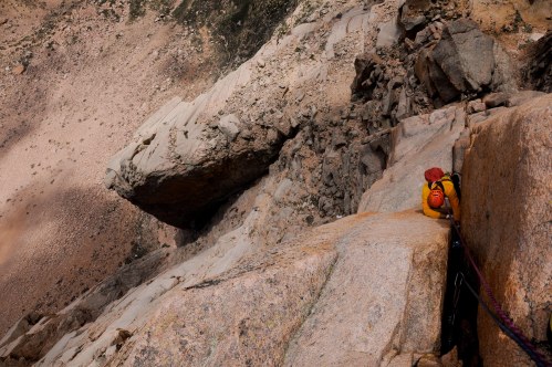
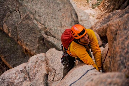
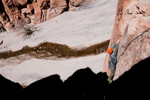
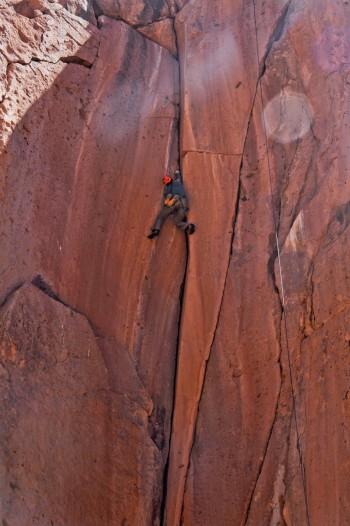
We spent the next few days climbing these incredible vulcanic rock formations and enjoying the little paradise of Valle Encantado situated next to the beautiful river Limay.
All the climbing is on the other side, but how to cross?
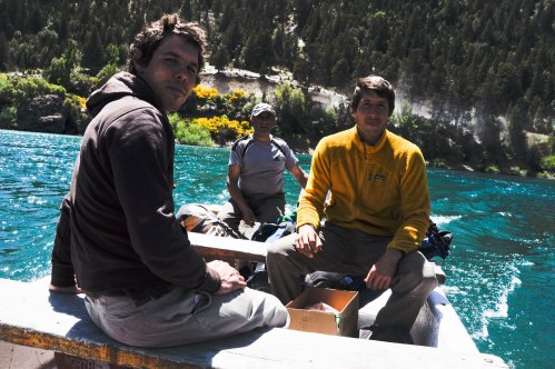
Crossing the river with Adrien, Louis and Luis
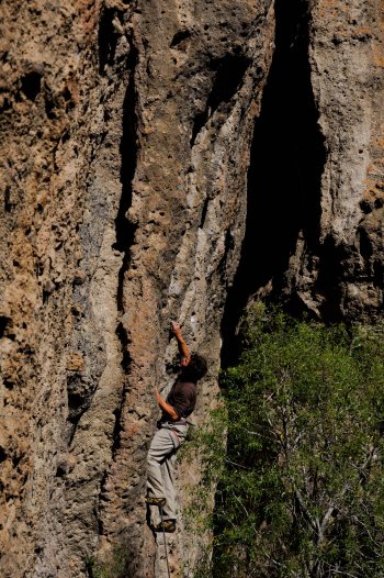
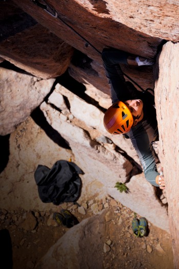
Adrien lost in structures 😉
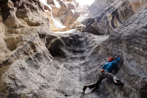
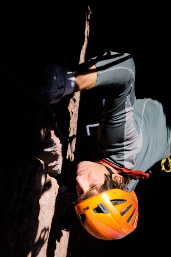
Louis in a very technical “canaletta”
The fairy tale should end here: the three brave climbers found their enchanted rockwalls, had hot showers every day and slept in real beds every night.
But as we learned later, the “estancia” is the property of the Van Ditmars, a family that has its origins in Holland and is also known as a big seller of Patagonia. Van Ditmar people were often leading the negociations between local landowners and the magnates (Joseph Lewis, the Benetton family) willing to acquire land in Patagonia. On top of the reward for the negociations, the Van Ditmar family is now administrator for many big landowners.
In the particular case of Valle Encantado it is said that Van Ditmar acquired it from an old lady in exchange of a flat in the city, a property that is now worth several millions of dollars… that is how it works in Argentina!
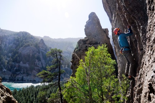
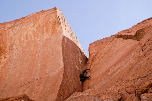
Climbing is still hard even with such a nice view
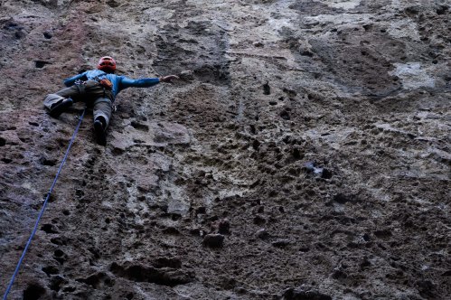
Many routes demand a lot of stamina, 35m of continous overhang
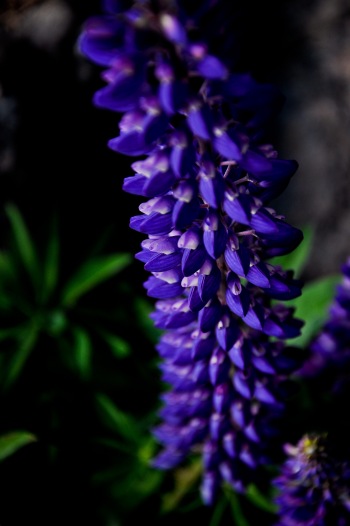
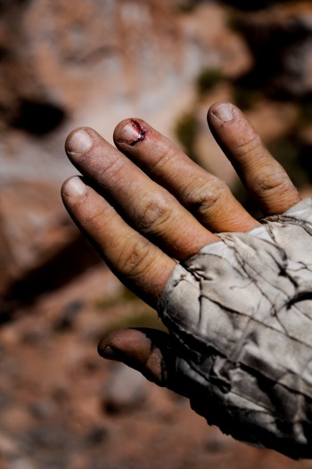
A reminder of the European labiate
PS. Our experience in the Valle Encantado was very positive, although there is something I did not mention before. In June 2011 the volcano Puyehue erupted and covered large parts of Patagonia with a thick layer of ash. Half of the cattle of the affected areas died and the rest has a diminished life expectancy. Valle Encantado has been greatly affected by the eruption as well. The whole place was covered with a layer of up to 30cm of very fine ash. When the winds blown in Patagonia as they often do, the sight is obscured by the flying ash, a natural disaster which will take at least 15 years to disappear.
Some more pictures can be seen here.
References:
Gonzalo Sánchez, “La Patagonia vendida”, Marea Editorial, 2006.
Wikipedia, “Patagonia”, 16. Dez 2012.